8 Kid-Friendly Hikes Near San Francisco
Eight practical family routes in San Francisco, Marin, and the Peninsula, with distance, surface, stroller, restroom, and reservation notes.
By Family Friendly SF Editorial Team · Official links are included for booking details that can change.
Start with today
Pick by the constraint that matters most
These are planning shortcuts, not rankings. Open the full route before leaving.
Want the short city outing already planned? Follow the free Presidio half-day plan for play, a picnic, and an optional waterfront walk, with a shortlist you can save or share.
Eight routes, side by side
Choose a route that fits your family
Lands End Coastal Trail
- Distance
- Up to 2.9 mi out and back
- Surface
- Accessible first segment; steps and grades later
- Plan ahead
- Parking, restrooms, and visitor center at Merrie Way
Tunnel Tops to Crissy Field
- Distance
- Flexible short out and back
- Surface
- Mostly flat, accessible paths
- Plan ahead
- Restrooms and paid accessible parking at Tunnel Tops
Glen Canyon lower trails
- Distance
- Choose about 1–2 mi
- Surface
- Nature-trail surfaces; carrier is safer
- Plan ahead
- Start near Elk and Chenery; playground and restrooms
Bernal Heights summit
- Distance
- Flexible short out and back
- Surface
- Paved access road or dirt trails
- Plan ahead
- Dogs may be off leash in the designated area
Muir Woods Main Trail
- Distance
- 0.5-, 1-, or 2-mi loops
- Surface
- Paved or boardwalk main route
- Plan ahead
- Reserve parking or shuttle before leaving
Tennessee Valley to the beach
- Distance
- About 3.4–3.5 mi round trip
- Surface
- Mostly level, unpaved trail
- Plan ahead
- No dogs; restrooms at the trailhead
Sawyer Camp segment
- Distance
- Choose a turnaround on a 6-mi segment
- Surface
- Paved and wheelchair accessible
- Plan ahead
- No drinking water; restrooms at ends and midpoint
Purisima Creek Redwoods
- Distance
- 0.25 mi or a longer out and back
- Surface
- Flat Redwood Trail; short grades on Purisima Creek Trail
- Plan ahead
- No dogs; parking capacity varies by entrance
Detailed route notes
Check the terrain, then choose your turnaround
A good family hike needs a clear start, a realistic distance, and enough detail to know whether the surface, restrooms, parking, and rules work for today. Use the comparison above to shortlist a route, then read its notes below.

San Francisco
4 routesLands End Coastal Trail
Up to 2.9 mi out and back
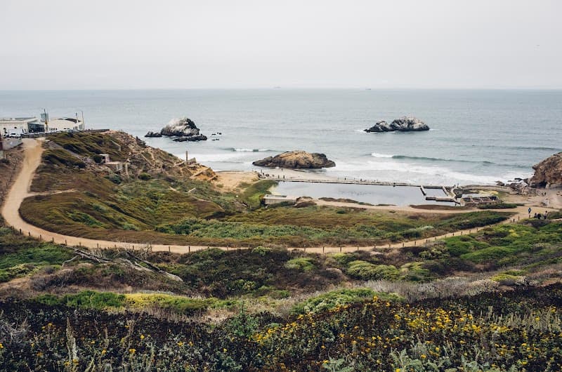
Start at Merrie Way, where parking, restrooms, food, and the visitor center make an easy family base. The first segment to Mile Rock Overlook is wheelchair accessible; turn around before the stepped and steeper sections if that is the right distance for your group.
Best fit
A scenic, flexible walk with a clear early turnaround and a wheels-friendly first segment.
Tunnel Tops to Crissy Field
Flexible short out and back
Use Tunnel Tops as the flexible start, then follow the accessible connection toward the Crissy Field waterfront. Turn around whenever energy changes instead of forcing a fixed loop; restrooms and paid accessible parking are available at Tunnel Tops.
Best fit
Strollers, wheelchairs, new walkers, and mixed-age groups that need an easy turnaround.
Glen Canyon lower trails
Choose about 1–2 mi
Start near the recreation center and turn the 3.7-mile trail network into a shorter lower-canyon out and back. The separate 1.2-mile Creeks to Peaks route adds a stronger climb; use the paved recreation area with wheels and bring a carrier for the nature trails.
Best fit
Walkers who enjoy an unpaved nature route, with a playground as an easy add-on.
Bernal Heights summit
Flexible short out and back
Choose the paved limited-access road or one of the dirt approaches, then turn back when the climb has delivered enough of the view. The hill is exposed, and the park includes a designated off-leash area, so keep children close around dogs.
Best fit
Families who want a short hill walk with a clear view payoff and can manage the climb.
Marin
2 routesMuir Woods Main Trail
0.5-, 1-, or 2-mi loops
Choose Bridge 2, 3, or 4 for a 0.5-, 1-, or 2-mile Main Trail loop. The asphalt, boardwalk, and firm main route works for wheelchairs and strollers; the hillside side trails climb and are not part of the accessible route.
Best fit
Mixed mobility and endurance levels, provided transportation is reserved in advance.
Tennessee Valley to the beach
About 3.4–3.5 mi round trip
The beach is about 1.7 to 1.75 miles from the trailhead, so the return distance is part of the decision. Bring all the water your group needs, save energy for the walk back, and keep children closely supervised around coastal water and changing weather.
Best fit
Steady walkers who are ready for the full beach out and back.
Peninsula
2 routesSawyer Camp segment
Choose a turnaround on a 6-mi segment
Treat the six-mile paved segment as a menu, not a target: choose a turnaround by time or distance and retrace your route. Bring water, watch for two-way bicycle traffic, and use the restrooms at the ends or near the midpoint.
Best fit
Strollers, wheelchairs, walkers, and bikes when total control over distance matters.
Purisima Creek Redwoods
0.25 mi or a longer out and back
Use the 0.25-mile Redwood Trail near Skyline Boulevard for the shortest, flat easy-access option with picnic tables and a restroom. Families wanting more can sample Purisima Creek Trail, where short sections reach 10 to 15 percent grades.
Best fit
A very short redwood walk, or a longer creek route for walkers comfortable with brief grades.
Want the short Presidio outing already planned?
Follow our free Presidio half-day plan for the Field Station, Outpost playground, a picnic, and an optional Crissy Field walk. It includes separate opening hours and a three-stop shortlist you can save or share. For other walks with wheels, compare the stroller-friendly routes.
Before you leave
Distances are round trip unless a route says otherwise. Conditions, closures, and reservation rules can change, so open the linked official page on the day you go.
What to pack
- Water — especially for Sawyer Camp, where the park says none is available.
- Layers — waterfront, forest, and ridge weather can feel very different on the same day.
- Food and a small trash bag — plan to pack out what you bring.
- Sun protection — exposed stretches appear on several routes.
- A carrier — useful when an unpaved trail or tired legs make wheels impractical.
- An offline copy of reservations and directions — particularly for Muir Woods and areas with limited service.
A safer way to choose
Start with the surface. A route described as stroller-friendly is not automatically an accessibility guarantee. Use the official accessibility page when mobility access is essential.
Set the turnaround first. Pick a time, landmark, or distance before starting, especially on out-and-back routes.
Check same-day conditions. Closures, weather, parking, and trail rules can change faster than an evergreen guide.
Leave room to stop early. The route is successful if the family finishes safely and wants to go again; completing every mile is optional.
Check the current booking details
Use the official sources below for current prices, availability, ages, and reservation rules.
Official sources and updates
- Lands End Trailhead — National Park Service ↗
- Presidio Tunnel Tops visitor information ↗
- Accessibility at Presidio Tunnel Tops ↗
- Glen Canyon Park — SF Recreation and Parks ↗
- Bernal Heights Park — SF Recreation and Parks ↗
- Muir Woods official trail guide ↗
- Muir Woods accessibility information ↗
- Muir Woods know-before-you-go and reservations ↗
- Tennessee Valley Trailhead — National Park Service ↗
- Sawyer Camp segment — San Mateo County Parks ↗
- Crystal Springs Regional Trail map and rules ↗
- Purisima Creek Redwoods Preserve — Midpen ↗